![](/images/other/stat-length.png)
![Trail Walking Perche en Nocé - Préaux-du-Perche Sud - Photo](https://media.geolcdn.com/t/1900/400/0969c1bf-78c8-4ceb-9cf9-65ed34443adf.jpg&format=pjpeg&maxdim=2)
Préaux-du-Perche Sud
guydu41
User
![Length](/images/other/stat-length.png)
![Max alt](https://static1.geolcdn.com/siteimages/upload/files/1508320355ic_sort_altitude_max_24dp.png)
![Uphill gradient](https://static1.geolcdn.com/siteimages/upload/files/1508320355ic_sort_den_pos_24dp.png)
![Km-Effort](/images/other/stat-length.png)
![Min alt](https://static1.geolcdn.com/siteimages/upload/files/1508320355ic_sort_altitude_min_24dp.png)
![Downhill gradient](https://static1.geolcdn.com/siteimages/upload/files/1508320355ic_sort_den_neg_24dp.png)
![Boucle](https://static1.geolcdn.com/siteimages/upload/files/16400158638029165_repeat_loop_refresh_sync_direction_icon.png)
![Walking](https://static1.geolcdn.com/sitytour/trail-icons/101.png)
2h09
Difficulty : Medium
![Scan this QR Code to open this trail in the SityTrail application](https://capi.geolives.com/qq0zvz2zws4bq2lad0pu/sitytour/trails/3707565/qr.png?size=200)
FREE GPS app for hiking
About
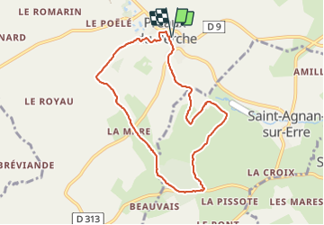
Trail Walking of 7.9 km to be discovered at Normandy, Orne, Perche en Nocé. This trail is proposed by guydu41.
Description
Le parcours commence depuis un parking à proximité d'une école, Rue du Verger, 61340 Préaux-du-Perche.
Ce village appartient à l'arrondissement de Mortagne-au-Perche et au canton de Nocé dans le département de l'Orne.
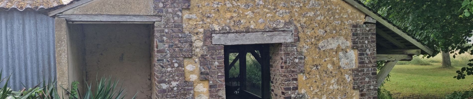
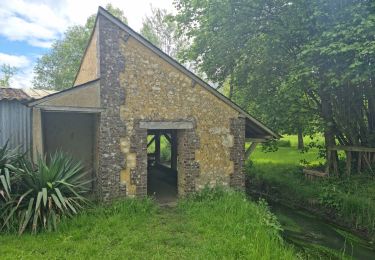
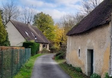
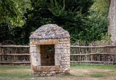
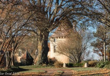
Le circuit en sens antihoraire passe à côté d'un lavoir, emprunte des sentiers dans un parc avec des passerelles, contourne un plan d'eau avec une aire de pique-nique et un deuxième lavoir puis rejoint un circuit PR balisé jaune.
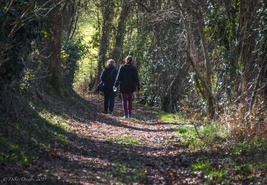
Ce circuit PR passe sur de nombreux chemins boisés à travers champs, creux par endroit, traverse puis contourne un bois.
Positioning
Comments
Trails nearby
![Trail Walking Perche en Nocé - Préaux-du-Perche Nord - Photo](https://media.geolcdn.com/t/375/260/a79e2268-207b-49cb-8d2a-d633dd57f73d.jpg&format=jpg&maxdim=2)
![Walking Walking](https://static1.geolcdn.com/sitytour/trail-icons/101.png)
Walking
![](/images/other/stat-length.png)
![](https://static1.geolcdn.com/siteimages/upload/files/16400158638029165_repeat_loop_refresh_sync_direction_icon.png)
![Trail Walking Berd'huis - SityTrail - Berd'huis - Condé-sur-Huisne 14 km - Photo](https://media.geolcdn.com/t/375/260/e562d127-d462-4485-b928-bb7147049073.png&format=jpg&maxdim=2)
![Walking Walking](https://static1.geolcdn.com/sitytour/trail-icons/101.png)
Walking
![](/images/other/stat-length.png)
![](https://static1.geolcdn.com/siteimages/upload/files/16400158638029165_repeat_loop_refresh_sync_direction_icon.png)
![Trail Walking Berd'huis - SityTrail - Berd'huis - Saint-Cyr-la-Rosière via Préaux-du-Perche 12 km - Photo](https://media.geolcdn.com/t/375/260/9f597d4c-6499-477b-a914-13f046dbb439.jpg&format=jpg&maxdim=2)
![Walking Walking](https://static1.geolcdn.com/sitytour/trail-icons/101.png)
Walking
![](/images/other/stat-length.png)
![](https://static1.geolcdn.com/siteimages/upload/files/16400158638029165_repeat_loop_refresh_sync_direction_icon.png)
![Trail Walking Saint-Cyr-la-Rosière - Au fil de la Rosière 7,1 Km - Photo](https://media.geolcdn.com/t/375/260/6ffb02c5-f518-43cf-b25f-e24d8f031465.jpg&format=jpg&maxdim=2)
![Walking Walking](https://static1.geolcdn.com/sitytour/trail-icons/101.png)
Walking
![](/images/other/stat-length.png)
![](https://static1.geolcdn.com/siteimages/upload/files/16400158638029165_repeat_loop_refresh_sync_direction_icon.png)
![Trail Walking Perche en Nocé - Nocé-Courboyer - Saint-Aubin-des-Grois 9,5 km - Photo](https://media.geolcdn.com/t/375/260/74d7cd8d-75a9-4a6d-8570-ba2a55254fab.jpg&format=jpg&maxdim=2)
![Walking Walking](https://static1.geolcdn.com/sitytour/trail-icons/101.png)
Walking
![](/images/other/stat-length.png)
![](https://static1.geolcdn.com/siteimages/upload/files/16400158638029165_repeat_loop_refresh_sync_direction_icon.png)
![Trail Walking Perche en Nocé - Val d'Enfer 17Km - Photo](https://media.geolcdn.com/t/375/260/285f82a6-4b4a-437a-b428-48270f65e19b.jpg&format=jpg&maxdim=2)
![Walking Walking](https://static1.geolcdn.com/sitytour/trail-icons/101.png)
Walking
![](/images/other/stat-length.png)
![](https://static1.geolcdn.com/siteimages/upload/files/16400158638029165_repeat_loop_refresh_sync_direction_icon.png)
![Trail Walking Perche en Nocé - Nobles logis (Préaux-du-Perche) 9,4Km - Photo](https://media.geolcdn.com/t/375/260/4db8b454-889b-47d7-bd12-5d83e5cd02fb.jpg&format=jpg&maxdim=2)
![Walking Walking](https://static1.geolcdn.com/sitytour/trail-icons/101.png)
Walking
![](/images/other/stat-length.png)
![](https://static1.geolcdn.com/siteimages/upload/files/16400158638029165_repeat_loop_refresh_sync_direction_icon.png)
![Trail Walking Perche en Nocé - Les Panoramas 5,5 Km - Photo](https://media.geolcdn.com/t/375/260/3ecdb278-3826-4aa6-b1de-61f0366a9a2c.jpg&format=jpg&maxdim=2)
![Walking Walking](https://static1.geolcdn.com/sitytour/trail-icons/101.png)
Walking
![](/images/other/stat-length.png)
![](https://static1.geolcdn.com/siteimages/upload/files/16400158638029165_repeat_loop_refresh_sync_direction_icon.png)
![Trail Walking Berd'huis - Bellême - Berd'huis 23 km - Photo](https://media.geolcdn.com/t/375/260/35d6aa94-04a5-460b-b4a9-5d8e7085755b.jpg&format=jpg&maxdim=2)
![Walking Walking](https://static1.geolcdn.com/sitytour/trail-icons/101.png)
Walking
![](/images/other/stat-length.png)
![](https://static1.geolcdn.com/siteimages/upload/files/16400158638029165_repeat_loop_refresh_sync_direction_icon.png)